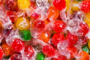

There is growing evidence showing a causal relationship between deforestation, the acceleration of climate change, and the extinction of precious flora and fauna. But identifying and measuring deforestation and the cultivation of specific commodities at a large scale and in sufficient detail is notoriously difficult. Barry Callebaut announce the release of a first-of-its-kind large-scale indicative High Carbon Stock (HCS) map covering Malaysia, Indonesia, and the Philippines.
A statement released on the Barry Callebaut website read:
Identifying the link between specific commodities and areas at risk of deforestation, can be extremely complex. At Barry Callebaut, we require our suppliers, such as palm and soy suppliers, to identify the forest areas that need protecting, and those that can be developed for agriculture. However, conducting this type of assessment is difficult, time consuming and, often, a costly exercise.
We needed a solution to support our suppliers that was more efficient, less expensive, and had the ability to scale. Moreover, we knew that artificial intelligence was already being used for climate change strategies, such as for predicting droughts, cloud cover, and greenhouse gas emissions.
The question we, therefore, asked ourselves was, how can we leverage existing deforestation methodology with artificial intelligence?
To answer that question, we teamed up with EcoVision Lab, part of the Photogrammetry and Remote Sensing group at ETH Zurich, who have the capability to develop highly automated artificial intelligence solutions. The group has long-standing experience in combining machine learning (deep learning) with remote sensing to address ecological challenges. The team at ETH Zurich is utilizing data from a NASA laser scanner attached to the International Space Station and imagery from the European Space Agency (ESA), which allows large areas to be mapped by applying artificial intelligence, limiting on-the-ground measurements to only very critical locations.
This collaboration led to the development of a publicly available, industry-first, indicative High Carbon Stock (HCS) map that identifies forests with high conservation value and areas where deforestation would cause the highest carbon emissions.
The development of the HCS map greatly supports the current approach of data taken from the field, which until now is the widely used approach to measure the link between commodity cultivation and deforestation, the so-called High Carbon Stock Approach (HCSA).
“This new method combining deep learning and publicly available satellite imagery is a true breakthrough because it provides a highly automated, transparent, objective tool that generates indicative HCS maps at global scale with unprecedented accuracy,” said Prof. Dr. Jan Dirk Wegner, Head of EcoVision Lab, ETH Zurich & University of Zurich.
Image credit: Barry Callebaut
To stay up to date on the latest, trends, innovations, people news and company updates within the global confectionery market please register to receive our newsletter here
Media contact
Kiran Grewal
Editor, International Confectionery
Tel: +44 (0) 1622 823 922
Email: editor@in-confectionery.com